Log in
All resources
Create a design
53,698 Free Images of German Language Maps
small atlas of the russian empire (1792)
maps in the british museum
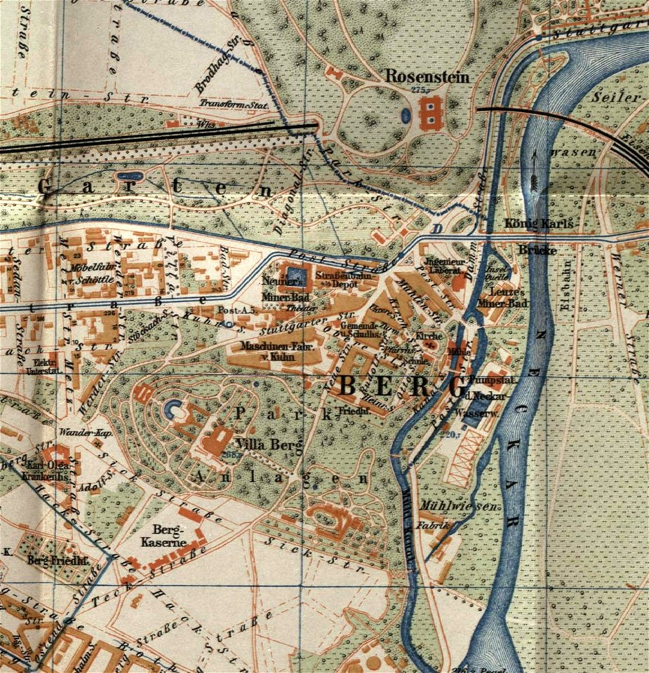
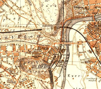
city maps with villa berg
maps by alexandre vuillemin
maps in the amsterdam museum
elementarwerk
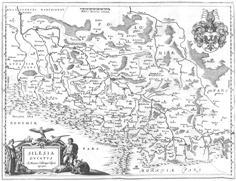
old maps of silesia
fonds ancely - bibliothèque municipale de toulouse - maps
atlas van loon
prints from the peace palace library
maps and topographical views by joris hoefnagel
engravings in the museum plantin-moretus
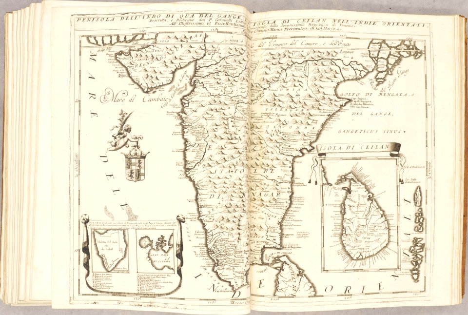
old maps of sri lanka
old maps of india
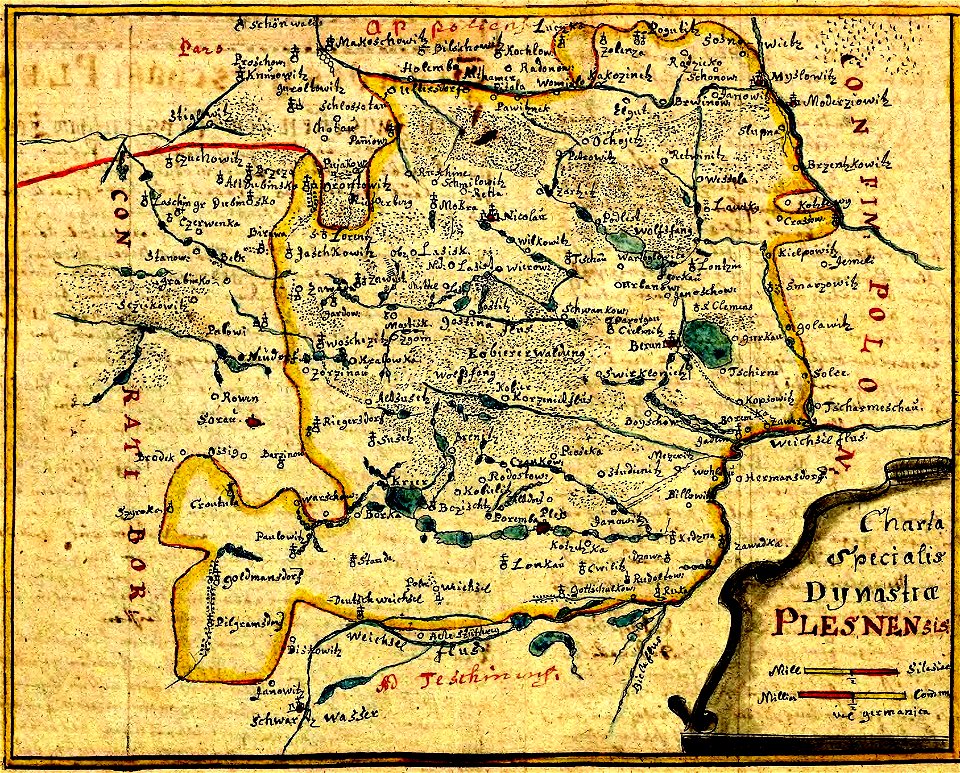
history of pszczyna
old maps of silesia
engravings of topographia bohemiae moraviae et silesiae
old maps of silesia
old maps of north rhine-westphalia
coats of arms on maps
files from the bodleian libraries
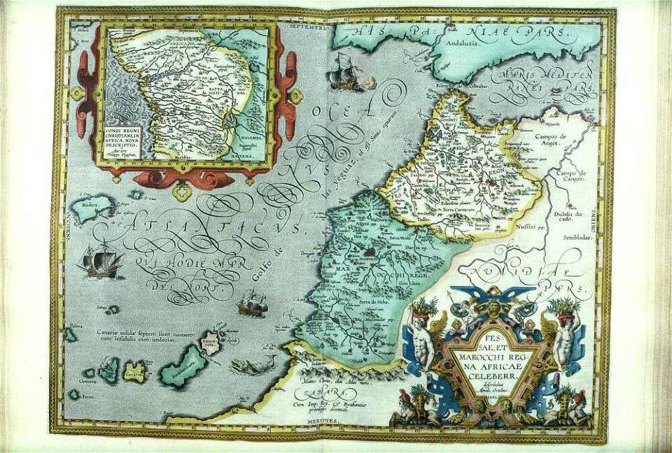
old maps of africa
fonds ancely - bibliothèque municipale de toulouse - maps
gustave bascle de lagrèze
maps made in the 17th century
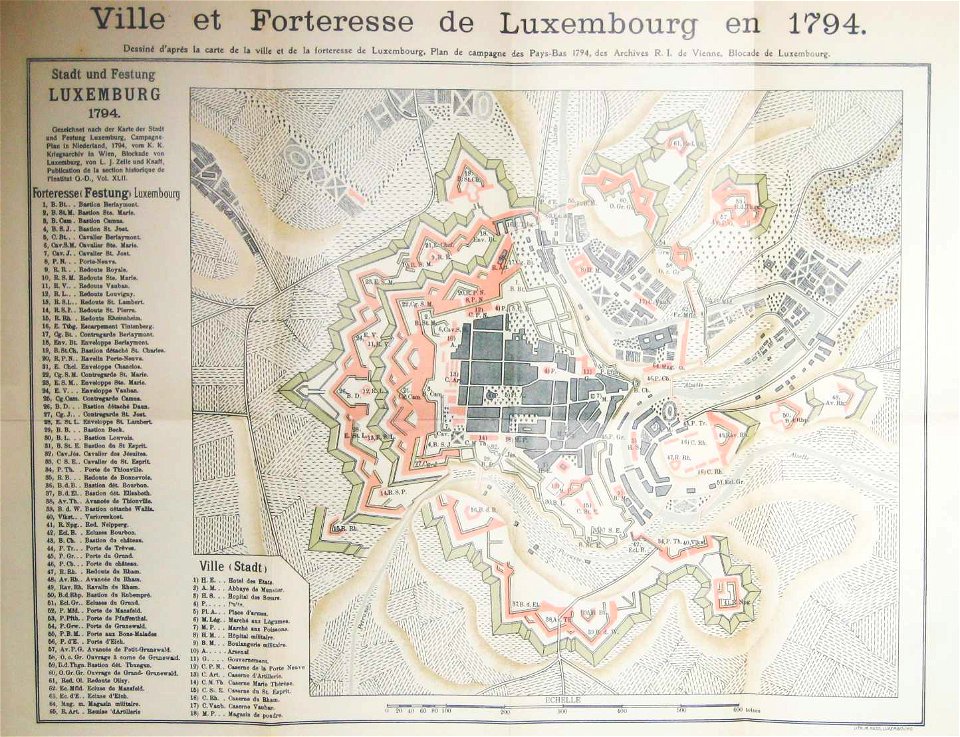
old maps of luxembourg
coats of arms of baden-württemberg
1710 maps
fonds ancely - bibliothèque municipale de toulouse - maps
historical images of pau
metropolitan improvements (1828) thomas hosmer shepherd
maps from the mechanical curator collection
windmills in art
bridge of arts
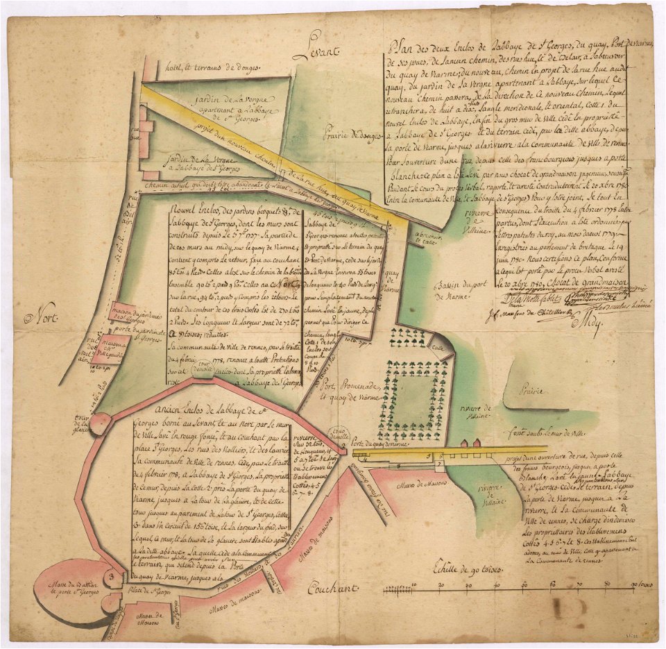
old maps of rennes
1780 maps
prints from the peace palace library
old maps of siberia
bibliothèque municipale de reims
rès. g 152
old maps of regions of france
baldwin iii
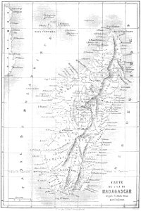
19th-century maps of madagascar
maps by alexandre vuillemin
pictorial maps
thüringiae
maps by willem and johannes blaeu
atlas van loon
small atlas of the russian empire (1792)
maps of yaroslavl governorate
small atlas of the russian empire (1792)
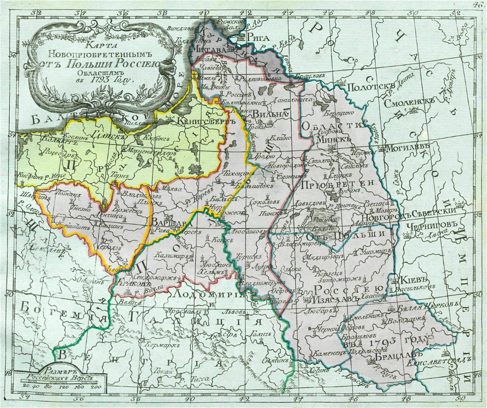
old maps of partitioned poland
small atlas of the russian empire (1792)
old maps of olonets governorate
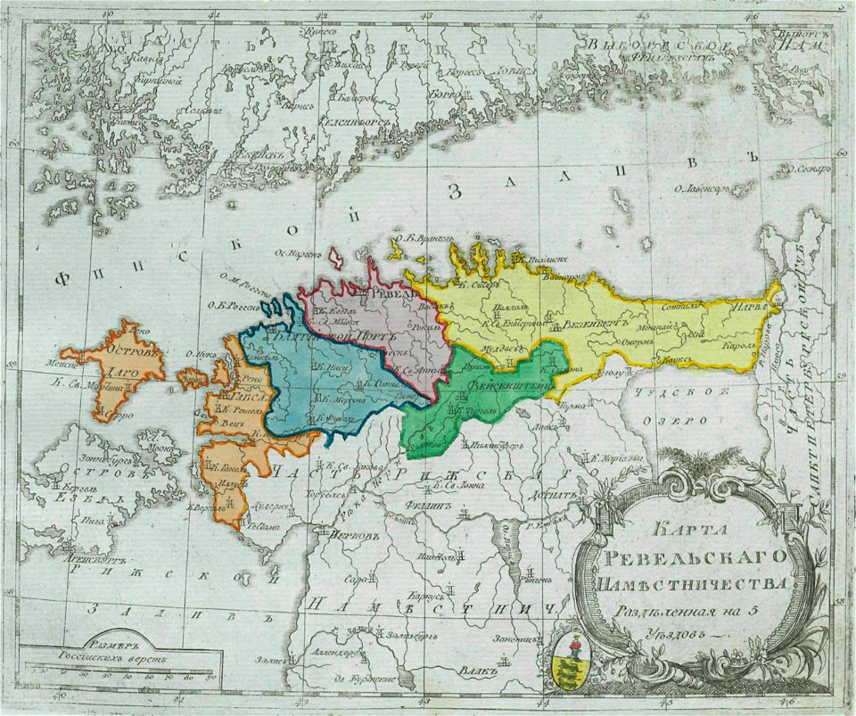
maps of estlandia governorate
18th-century maps of estonia
small atlas of the russian empire (1792)
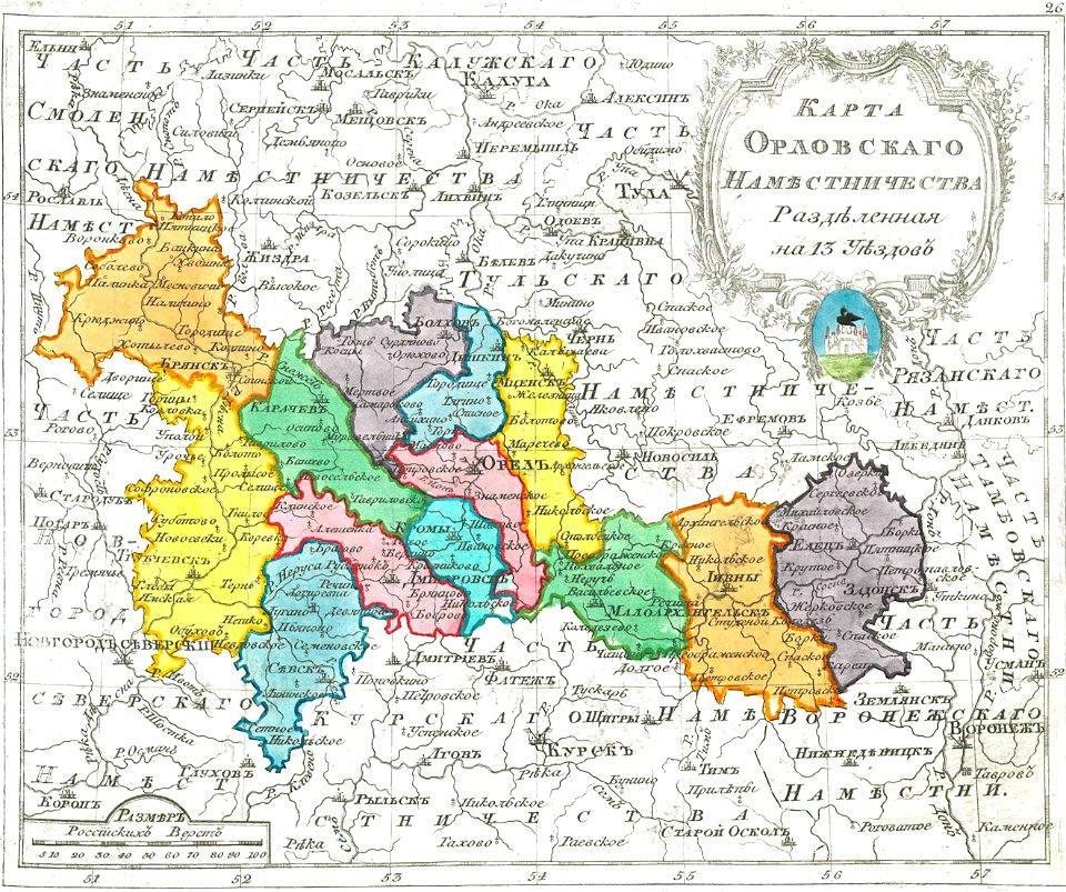
maps of oryol governorate
small atlas of the russian empire (1792)
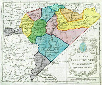
maps of saratov governorate
maps in the library of congress
p.s. duval & son
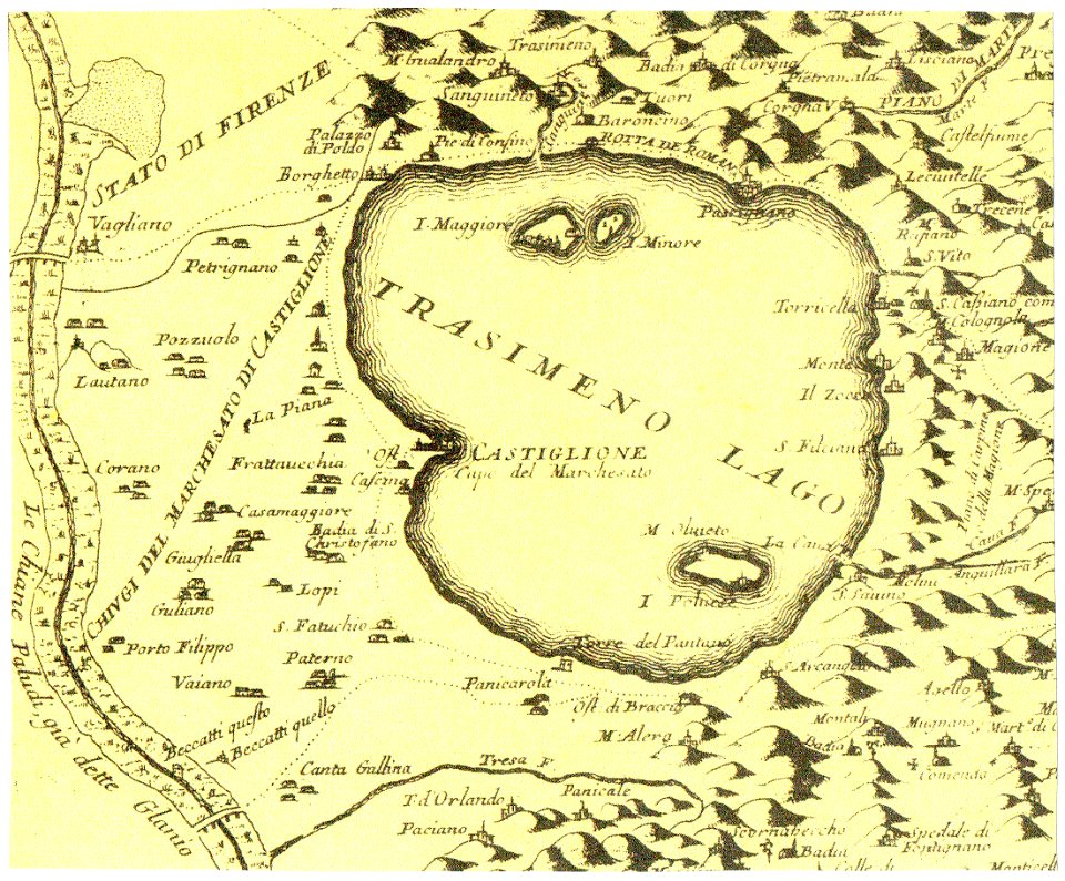
historical images of castiglione del lago
old maps of umbria
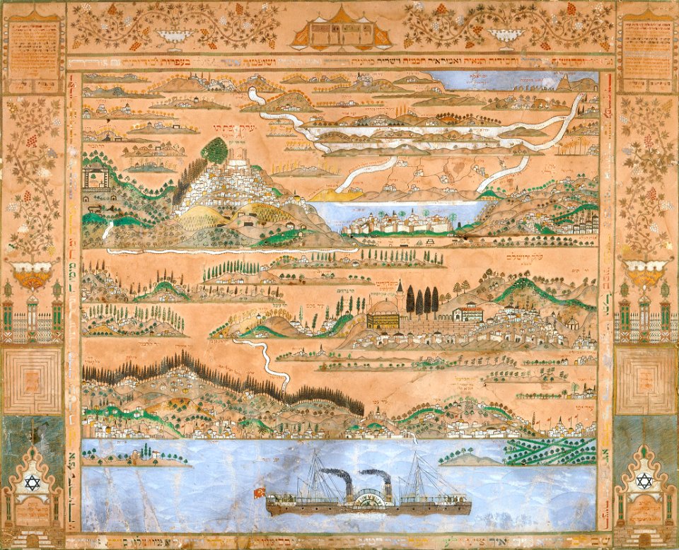
collections of the jewish museum (new york city)
old maps of israel
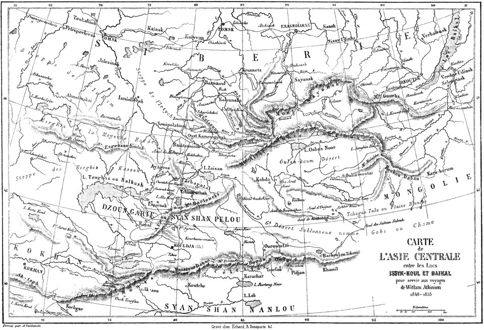
volume 7 of le tour du monde
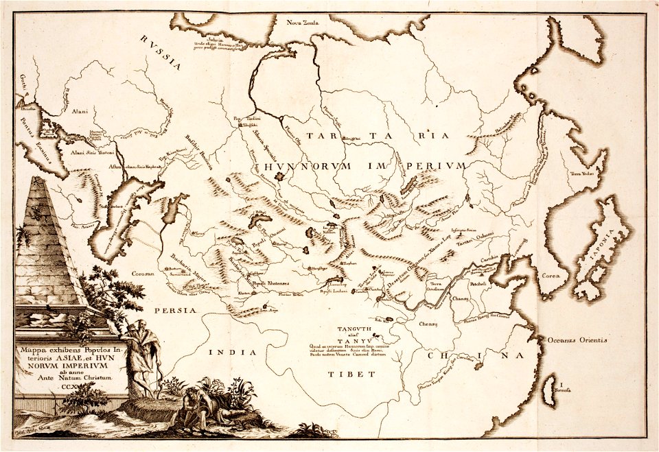
maps of central asia
1880 maps
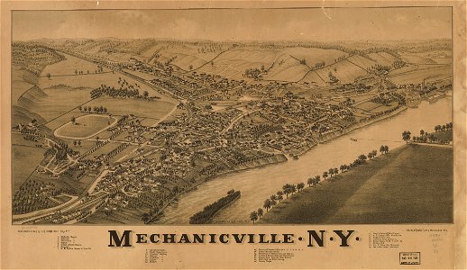
new york
charts and maps of the royal museums greenwich
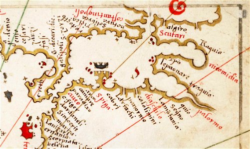
old maps of the aegean sea
paintings in the huntington library
vallard atlas
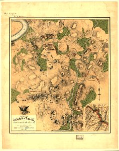
hand-drawn maps and views of world war i battlefields by h.m.
old maps of albania
maps by johannes janssonius
maps by wenzel hollar
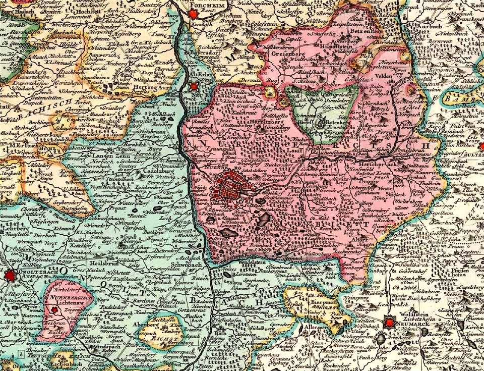
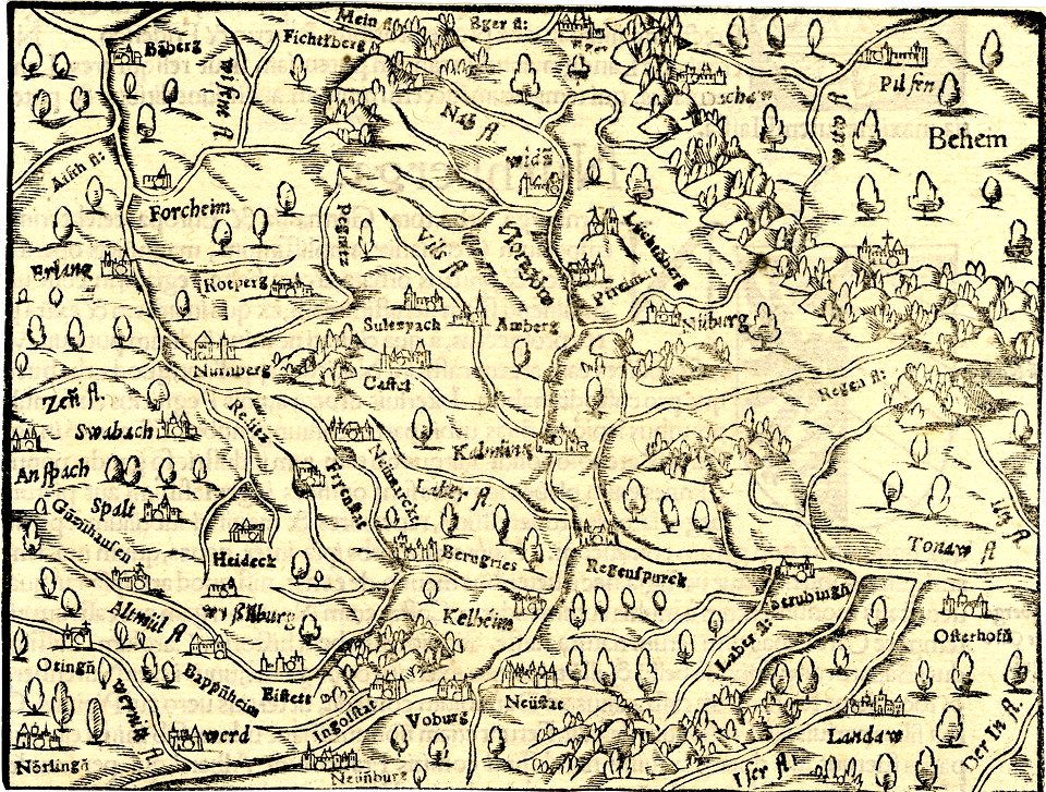
old maps of nuremberg
covens en mortier
charts and maps of the royal museums greenwich
maps of the sea of marmara
prints from the peace palace library
zeelandic flanders
johannes vingboons
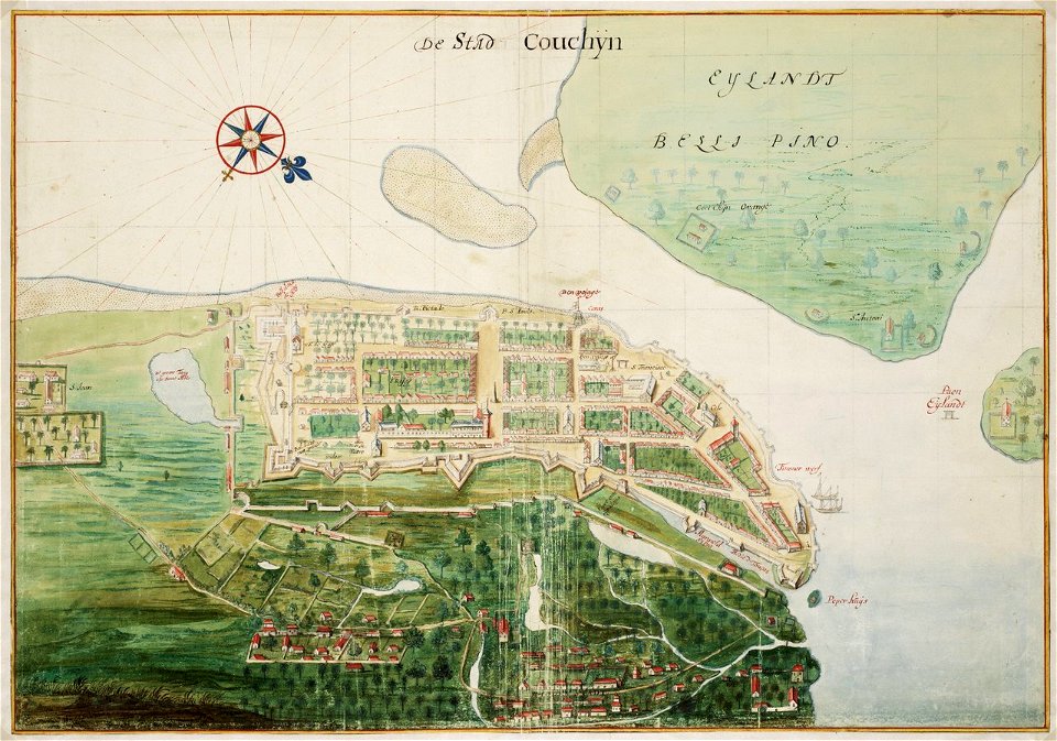
kerala
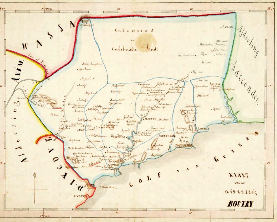
old maps of the dutch gold coast
1859 maps
dutch 18th-century prints in the rijksmuseum amsterdam
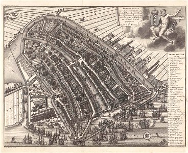
maps of amsterdam
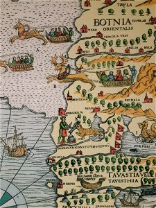
carta marina (details)
korsholm
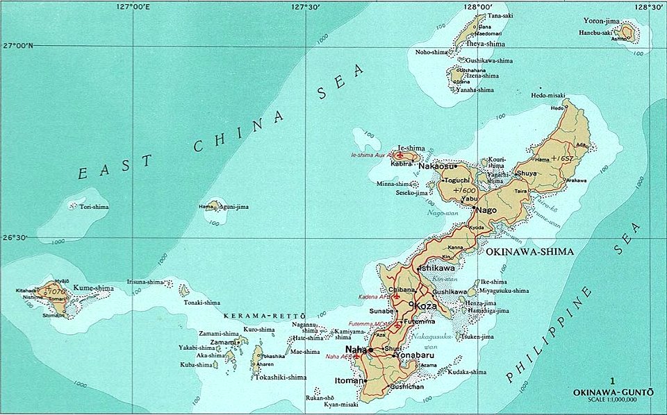
okinawa island
aguni island
old maps of baden-württemberg
friedrichshafen in art
old maps of rhineland-palatinate
engravings by matthäus merian
maps of archaeological sites in italy
old maps of tuscany
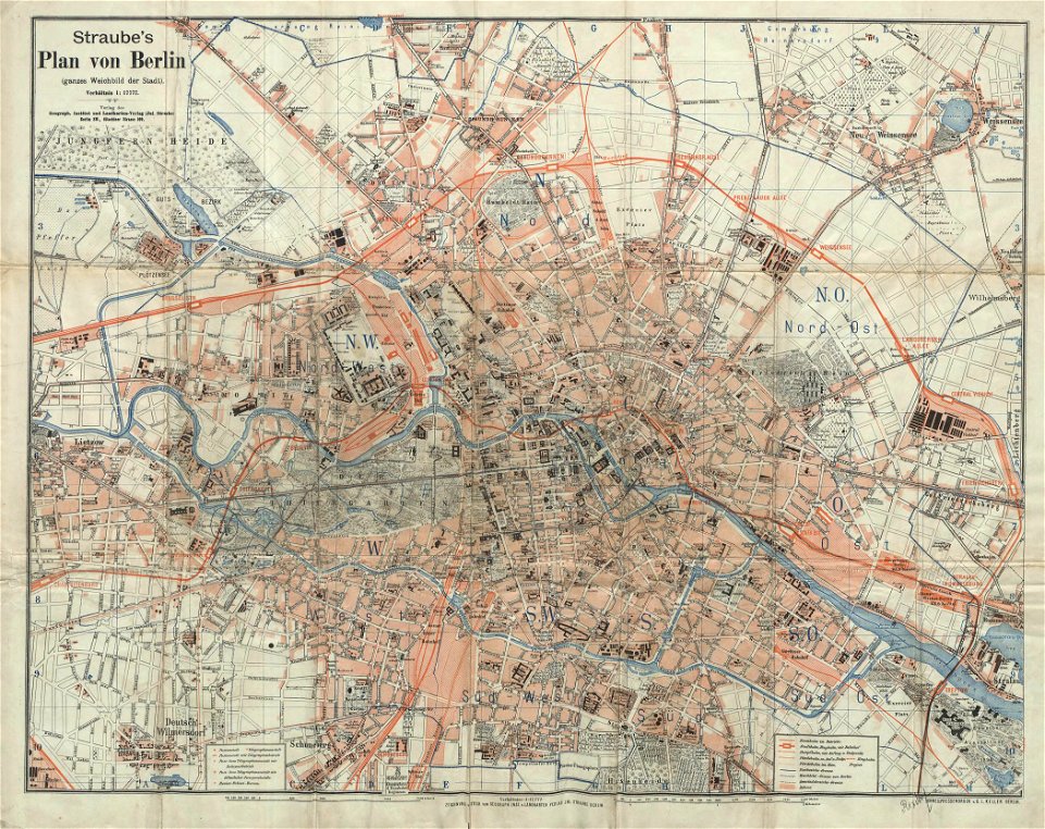
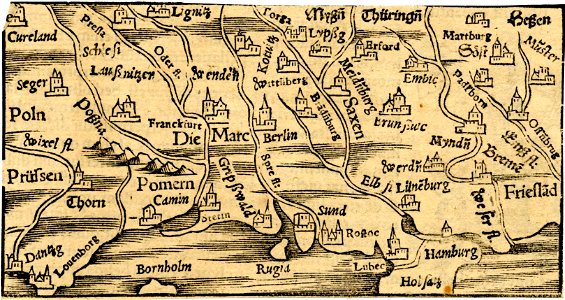
19th-century maps of berlin
1896 maps
national diet library
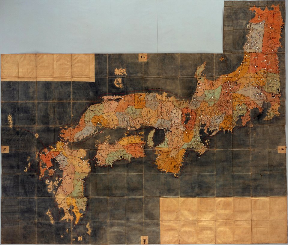
keichō kuniezu
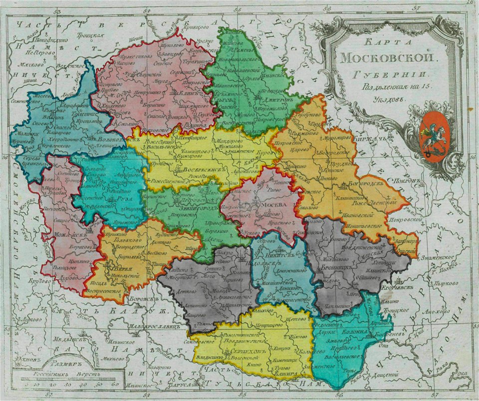
old maps of moscow governorate
maps of moscow governorate
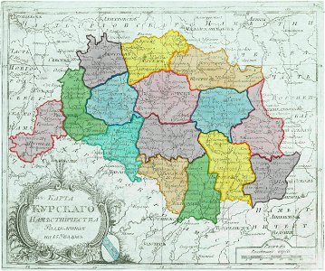
old maps of kursk governorate
maps of kursk governorate
maps by alexandre vuillemin
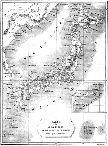
19th-century maps of japan
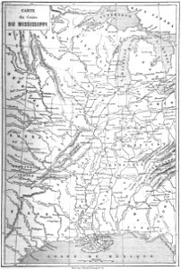
old maps of mississippi (state)
maps by alexandre vuillemin
maps of paris from the norman b. leventhal map center
siege of paris, 1870-1871
magni ducatus lithuaniae
1613 maps of europe
south carolina
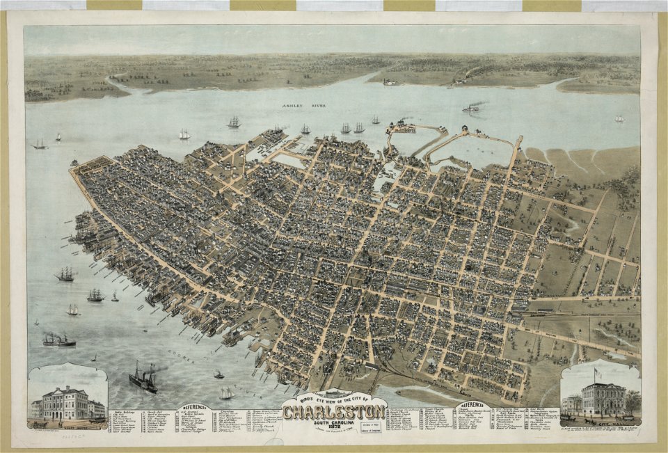
charleston
maps by willem and johannes blaeu
kreis plön
sticklinge gård
maps of lidingö
maps of södermanland county
mariefred
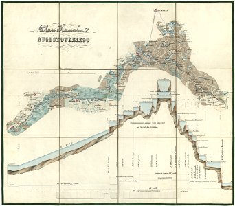
maps of the augustów canal
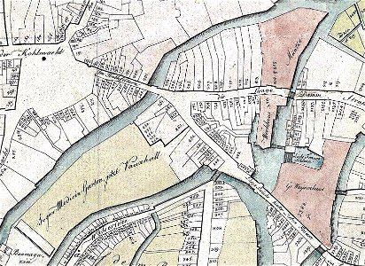
maps of heilbronn
allee (heilbronn)
maps of luxembourg city walls
city maps with villa berg
old maps of braunschweig
bammelsburg
old maps of braunschweig
hutfiltern
city maps with villa berg
city maps with villa berg
city maps with villa berg
1760s maps of the world
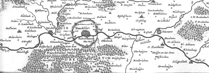
old maps of hesse
dreieich
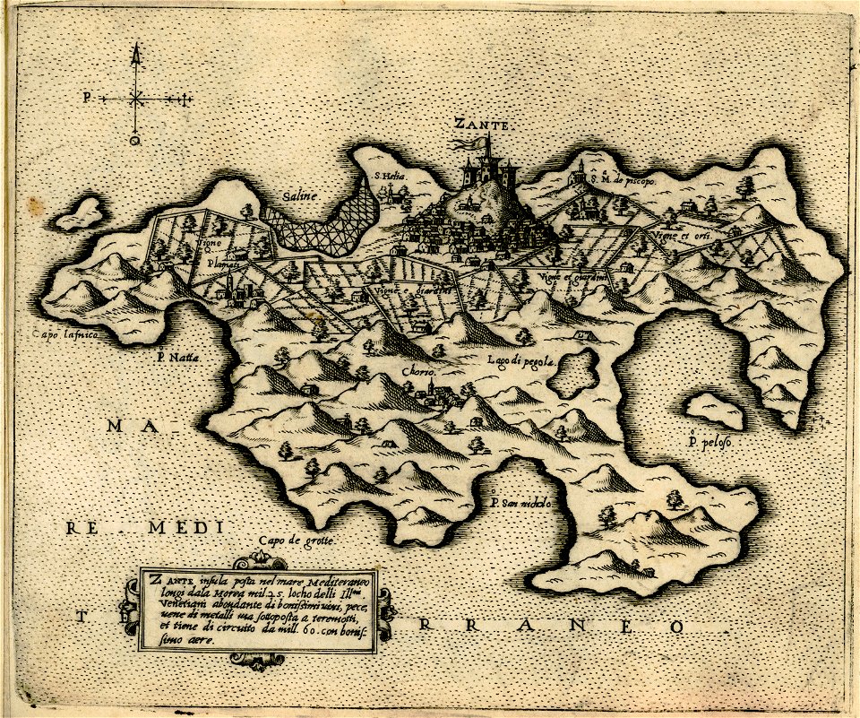
maps of zakynthos
giovanni camocio
maps in the british museum
maps in the british museum
maps in the british museum
maps in the british museum
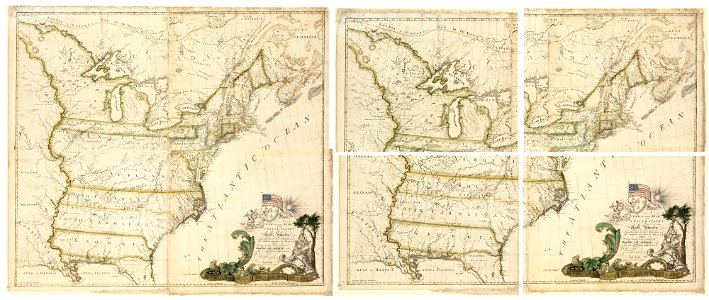
maps of the united states
maps in the amsterdam museum
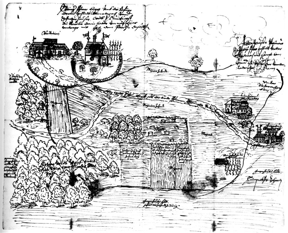
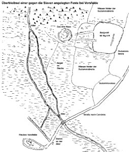
burgwall vorsfelde
maps of vorsfelde
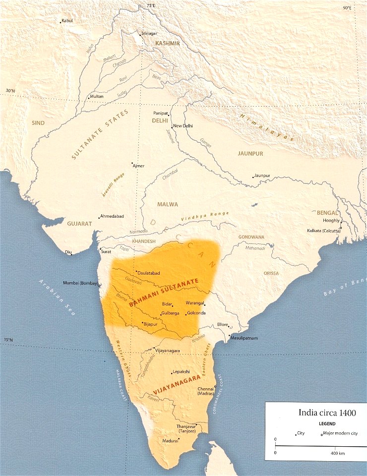
maps of sultanates in india
braun & hogenberg
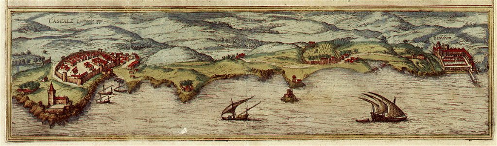
maps of cascais
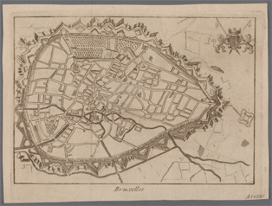
maps in the british museum
braun & hogenberg
maps of rome
old celestial maps
andreas cellarius
old maps of europe
elementarwerk
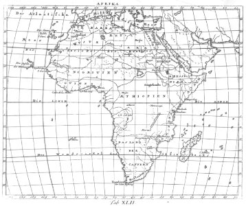
1770s maps of africa
elementarwerk
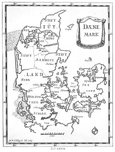
1770s maps of denmark
elementarwerk
star location maps
andreas cellarius
maps in the stadsarchief amsterdam
maps in the amsterdam museum
maps in the amsterdam museum
maps in the stadsarchief amsterdam
old maps of southeast asia
maps in the british museum
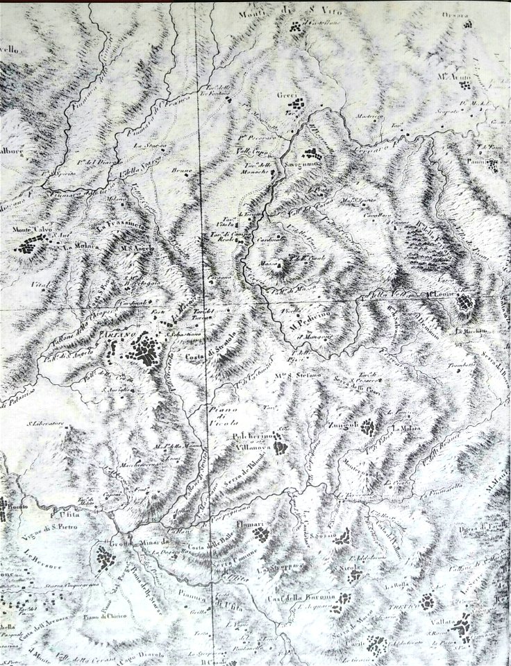
old maps of ariano irpino
maps of isfahan
pascal coste
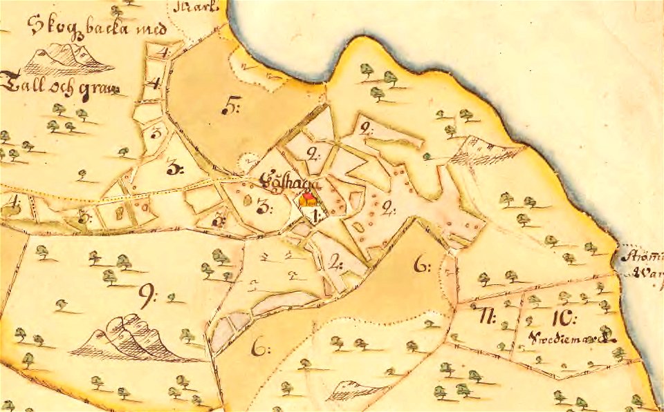
maps of lidingö
gåshaga gård
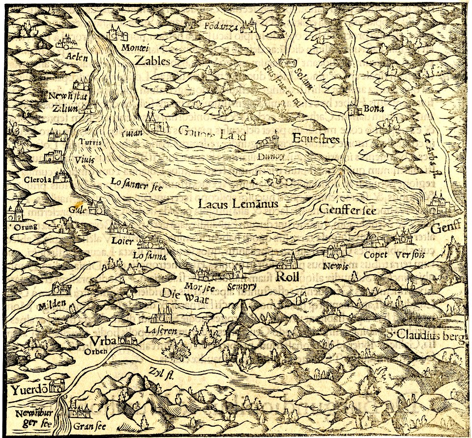
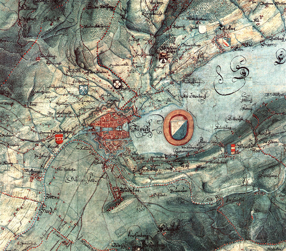
old maps of zürich
gygerkarte
17th-century maps of stockholm
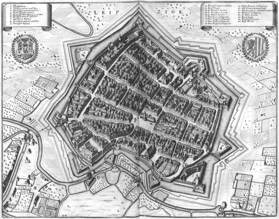
old maps of leipzig
elsterfloßgraben
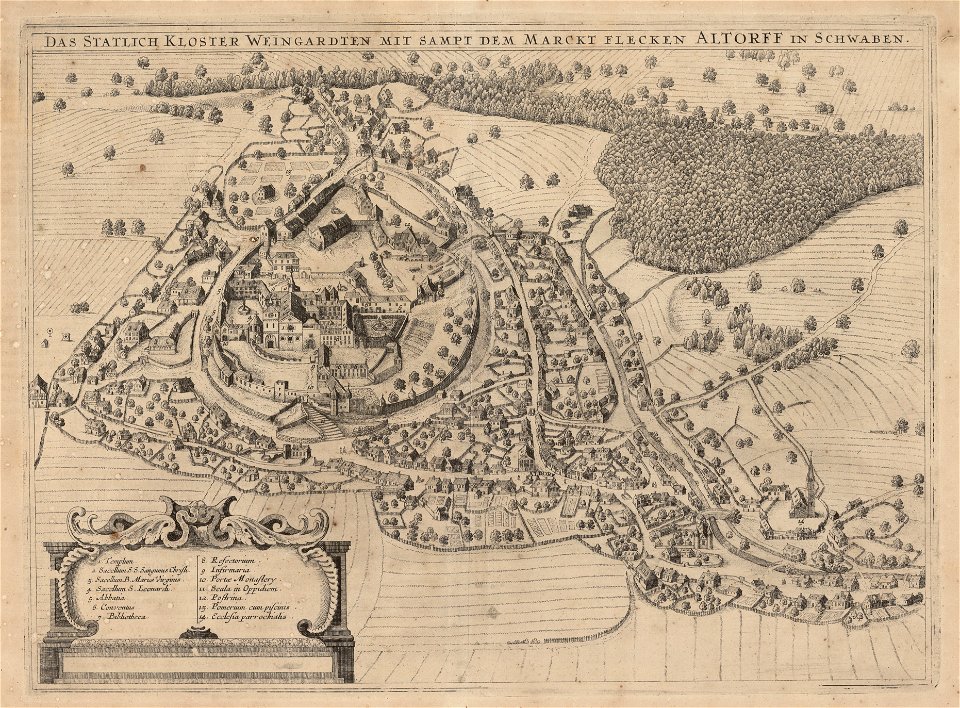
old maps of bavaria
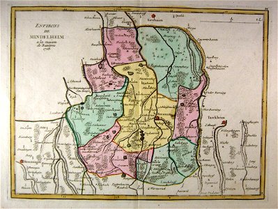
mindelheim
old maps of mato grosso
maps of the deccan sultanates
6901 - 7000 of 53,698
Next page
/ 537